Lowertown East
A mostly rental area with a younger median age and more children than Lowertown West.
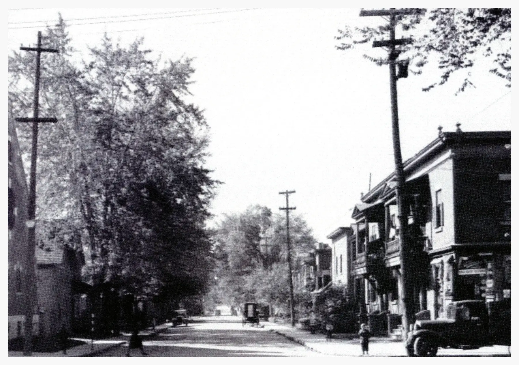
Lowertown East had 6,885 residents in 4,090 private dwellings in the 2021 census, via the Ottawa Neighbourhood Study. Population: 6,885 (2021).
Updated · Facts on this page link to their sources
About Lowertown East
Lowertown East had 6,885 residents in 4,090 private dwellings in the 2021 census, via the Ottawa Neighbourhood Study. The median age was 35.2, and children aged 0–14 were 15.0% of residents. Apartments in buildings of five or more storeys were 56.2% of dwellings, and 85.8% of households rented. The ONS neighbourhood-average Walk Score is 71 and Bike Score is 96.
Boundaries
Ottawa Neighbourhood Study area: Lowertown East. ons-sqo.ca ons-sqo.ca
Homes
In the 2021 census, via the Ottawa Neighbourhood Study, apartments were 75.8% of Lowertown East dwellings (56.2% in buildings of five or more storeys, 19.6% in buildings under five storeys). Row houses were 17.2%, semi-detached houses 3.3%, single-detached houses 1.8% and flats in a duplex 1.7%. Tenure was 85.8% renter and 14.0% owner households, and the median owner-estimated dwelling value was $650,000. ons-sqo.ca
- Population 6,885 (2021 census, via the Ottawa Neighbourhood Study)
- Median age 35.2; children 0–14 are 15.0% and seniors 65+ are 17.6% (2021)
- 24.8% of people had French as the language most spoken at home (2021)
- Sainte-Anne Catholic Elementary School and York Street Public School are each about 0.3 km away, straight line
- De la Salle Public High School is about 0.2 km away, straight line
- Tree canopy coverage was 18.4% (2024)
Around Lowertown East
Walking rings at 5, 10 and 15 minutes from the neighbourhood centre.
Schools
10 nearbyDe la Salle Public High School
CÉPEO501 rue Old St-Patrick Stmaps.ottawa.ca cepeo.on.ca
180 m2 min walkSainte-Anne Catholic Elementary School
CECCE235 prom. Beausoleil Drmaps.ottawa.ca ecolecatholique.ca
260 m3 min walkYork Street Public School
OCDSB310 rue York Stmaps.ottawa.ca ocdsb.ca
260 m3 min walkMacDonald-Cartier Academy
Independent270 rue Crichton Stmaps.ottawa.ca
600 m8 min walkFern Hill School
Independent50 rue Vaughan Stmaps.ottawa.ca
770 m10 min walkFrancojeunesse Public Elementary School
CÉPEO119 rue Osgoode Stmaps.ottawa.ca cepeo.on.ca
1.1 km14 min walkTrille-des-Bois Public Elementary School
CÉPEO140 rue Genest Stmaps.ottawa.ca cepeo.on.ca
1.2 km15 min walkPublic Elementary School Mauril Bélanger
CÉPEO307 rue Montgomery Stmaps.ottawa.ca cepeo.on.ca
1.2 km15 min walkSt. Brigid School
OCSB200 ch. Springfield Rdmaps.ottawa.ca ocsb.ca
1.3 km16 min walkLisgar Collegiate Institute
OCDSB29 rue Lisgar Stmaps.ottawa.ca ocdsb.ca
1.6 km19 min walk
Straight-line distances from the Lowertown East centre. Living near a school does not guarantee a place: confirm the designated school for an address with each board. All schools and board locators.
Parks & places
10 nearbyJules Morin Park
Active Recreation park
400 Clarence Street East, Ottawamaps.ottawa.ca
110 m1 min walkOttawa Lowertown Community Centre and Pool
Active Recreation park
40 Cobourg Street, Ottawamaps.ottawa.ca
130 m2 min walkOutdoor rink, Jules Morin Park (Outdoor Rink)
Outdoor rink (winter, weather permitting)
400 Clarence St. E.maps.ottawa.ca ottawa.ca
140 m2 min walkLowertown Cmplx
Recreation Complex
40 Cobourg Stmaps.ottawa.ca ottawa.ca
140 m2 min walkPorter Island
Passive Recreation park · waterfront access
100 Island Lodge Road, Vaniermaps.ottawa.ca
370 m5 min walkSplash pad, Bordeleau Park
Splash pad (summer only)
349 Bruyère Street, Ottawamaps.ottawa.ca ottawa.ca
370 m5 min walkMacDonald Gardens Park
Active Recreation park
99 Cobourg Street, Ottawamaps.ottawa.ca
420 m5 min walkBordeleau Park
Active Recreation park · waterfront access
349 Bruyère Street, Ottawamaps.ottawa.ca
430 m5 min walkRose Park
Active Recreation park
310 Bruyère Street, Ottawamaps.ottawa.ca
440 m5 min walkOttawa Public Library Rideau Branch
Public Library
377 Rideau Stmaps.ottawa.ca biblioottawalibrary.ca
470 m6 min walk
Shops & dining
10 nearbyPharmasave
Pharmacy
423 Rideau Streetopenstreetmap.org
420 m5 min walkLoblaw Pharmacy
Pharmacy
375 Rideau Streetopenstreetmap.org
440 m5 min walkRemedy'sRx
Pharmacy
545 Rideau Streetopenstreetmap.org
460 m6 min walkLoblaws
Supermarket
363 Rideau Streetopenstreetmap.org
480 m6 min walkI.D.A.
Pharmacy
390 Rideau Streetopenstreetmap.org
490 m6 min walkShoppers Drug Mart
Pharmacy
322 Rideau Streetopenstreetmap.org
610 m8 min walkGuardian
Pharmacy
5 Beechwood Avenueopenstreetmap.org
630 m8 min walkPharmasave
Pharmacy
306 Rideau Streetopenstreetmap.org
640 m8 min walkMetro
Supermarket
255 Rideau Streetopenstreetmap.org
740 m9 min walkMetro
Supermarket
50 Beechwood Avenueopenstreetmap.org
790 m10 min walk
Getting around
TransitRideau station
O-Train Line 1
openwikidata.org en.wikipedia.org
1.2 km14 min walkLaurier North station
Transitway / transit station (City of Ottawa transit stations layer)
openmaps.ottawa.ca
1.2 km15 min walkLaurier South station
Transitway / transit station (City of Ottawa transit stations layer)
openmaps.ottawa.ca
1.2 km15 min walkMacKenzie King station
Transitway / transit station (City of Ottawa transit stations layer)
openmaps.ottawa.ca
1.3 km16 min walkO-Train
Rideau station is about 1.2 km away in a straight line (open; Line 1).
O-Train
uOttawa station is about 1.6 km away in a straight line (open; Line 1).
Transitway / bus
Laurier North station is about 1.2 km away in a straight line (open).
Downtown
Parliament Hill is about 1.8 km away in a straight line.
For sale in Lowertown East
No Lowertown East homes on lowertown.homes right now
Selling here? Get a website for your home, or browse every home for sale in the area.
Neighbouring areas
Quick answers
Short answers first; each links to the full answer and its sources.
What are homes like in Lowertown?
Homes in Lowertown are mostly apartments. In the 2021 census, via the Ottawa Neighbourhood Study, apartments were 84.8% of dwellings in Lowertown West and 75.8% in Lowertown East. Row houses were 6.9% (West) and 17.2% (East), and single-detached houses under 2% in both.
As of 2026-10 · ons-sqo.ca ons-sqo.ca
What is the nearest O-Train station to Lowertown?
Rideau station on Line 1 is the nearest O-Train station to both parts of Lowertown. It is about 0.7 km from the centre of Lowertown West and about 1.2 km from the centre of Lowertown East, measured as the crow flies.
As of 2026-10 · wikidata.org wikidata.org
How do people in Lowertown get to work?
In the 2021 census, via the Ottawa Neighbourhood Study, Lowertown West workers most often walked (37.9%) or went by car (35.5%), with 17.9% using public transit. In Lowertown East, 45.1% went by car, 24.2% by public transit and 23.2% on foot.
As of 2026-10 · ons-sqo.ca ons-sqo.ca
What parks and trails are in Lowertown?
City of Ottawa data lists 14 parks in and around Lowertown, including MacDonald Gardens Park, Porter Island, Jules Morin Park, Bordeleau Park and Bingham Park. Bingham Park is about 0.2 km from the centre of Lowertown West and Jules Morin Park about 0.1 km from the centre of Lowertown East, both straight-line. This guide has no trail data.
As of 2026-10 · maps.ottawa.ca maps.ottawa.ca
Is Lowertown walkable?
The Ottawa Neighbourhood Study's neighbourhood-average Walk Score is 58 for Lowertown West and 71 for Lowertown East. In the 2021 census, 37.9% of Lowertown West workers and 23.2% of Lowertown East workers commuted on foot.
As of 2026-10 · ons-sqo.ca ons-sqo.ca
Is Lowertown good for families?
The census shows a different mix in each area. In 2021, children aged 0–14 were 15.0% of Lowertown East residents but 3.4% of Lowertown West residents, and average household size was 1.9 and 1.5 respectively. Schools, parks and a community centre are close by, but families must confirm school catchments with each board.
As of 2026-10 · ons-sqo.ca ons-sqo.ca